Tom Hurtz is a biker who thinks America is best experienced from the back of a motorcycle. The photos and commentary are from his 2017 journey through South Dakota’s Badlands. This is part two of a series. Here’s the link to Part 1.
June 26, 2017
Devil’s Tower and Wyoming
According to the GPS we rode 282 miles today. I have been having trouble with pain in my right shoulder after long rides on this bike. But I like this bike and it is good for long trips. With the large gas tank and good gas mileage I have a range over 300 miles and the seat is comfortable. So, I bought some handlebar mounts that move the handlebars up and back 3/4″. It really seemed to work. I have no shoulder pain at all today. So that’s good!
The scenery today was unbelievable! We rode on top of this ridge and when you looked to the west you could see so far the horizon just kind of faded off. We reached about 6,700′ in altitude. I think that is the highest we’ve been so far. It was very green at these altitudes with lots of dark pine trees. The color contrasts were amazing. Down in the valleys it was drier and more brown, but also very pretty. Every corner we went around you wanted to stop and take pictures. But we would have to take off gloves get out the camera, etc. So I didn’t get as many photos as I would have liked. I also forgot my camera today, so all I have are phone pics.
A cool red rock formation we saw.
Those were photos on the way to Devil’s Tower. I wish we could have stopped more but we had so far to go.
When we first saw Devil’s Tower we were still over 15 miles away according to the GPS. It is really big!
Here are some photos as we approached the tower.

The ride back to Rapid City was very pretty, and windy! The last 50 miles was pretty tough. It was a monumental day! Get it?
Vanishing Point
I love these roads the look like they go on forever.
Sometimes the interstate looks like two gray ribbons laying on the surface of the ground.
June 27, 2017
Scenic South Dakota
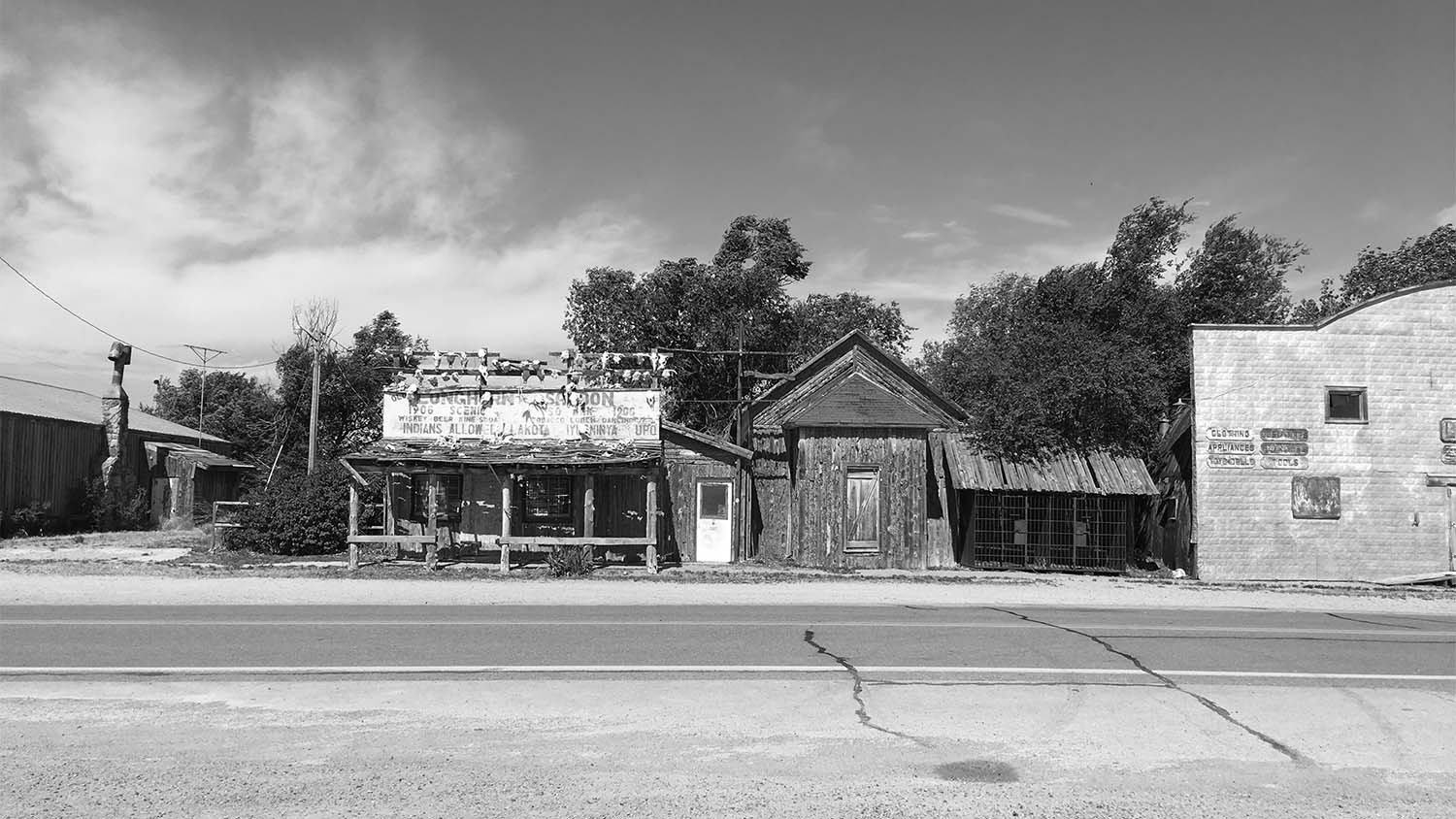
Just outside of the Badlands is Scenic, South Dakota. There was a post office, a residence, a church and a few other buildings. It looked like a movie set with the tumble weeds blowing by. I’m not sure that the town is for real. There was a couple from Canada that thought the same thing. There was also so odd flags flying that looked liked Mexican flags with Menoras on them.
This may explain some of it.
Anyway here are some pics of Scenic.
The Badlands
I’ve always wanted to see the Badlands ever since I saw pictures of it as a kid. We went today and it was incredible. It’s the strangest landscape you could imagine. You really can’t describe it and do it justice. Below is a bit of an explanation.
We entered the Badlands from the south out of a little town called Interior. We could see them from a distance for many miles, but when you got close it was amazing. This is the softest, driest and crumbly soil. But there are rock layers within that helps hold it all together. The formations that this makes are fantastic. I’ll throw some pictures in from this trip, because it is hard to describe.
We also saw some deer, they look like deer in Kentucky except they seem a little lighter colored.
The Badlands was really worth the trip. It is otherworldly.
After the Badlands we went to Wall Drug in the town of Wall. Wall Drug was really the whole town of Wall as far as I could tell.
We felt like we had to go because we saw about two hundred signs for Wall Drug as we worked our way across the state on the way here. It was probably the best place to buy stuff you don’t need I have seen. It makes See Rock City look like amateur hour. I didn’t take any photos, so I’m not posting any. But I can say I’ve been to Wall Drug!
When we got back to our hotel, or is it a motel, we had a wicked storm pass through. It was pretty spectacular. It blew the door off the front of the hotel/motel. But it was exciting.
Does this Taco Bell look odd? I think it does.
You kind expect to see Napoleon Dynamite riding a horse down the hill behind it.
Having fun. Maybe we’ll see some buffalo tomorrow!
Mount Rushmore
We rode to Mount Rushmore today as part of a big loop through the Black Hills. I’m going to divide today’s miles up into several posts, starting with Mount Rushmore. Here is a blurb form Wikipedia about the concept of Mount Rushmore.
South Dakota historian Doane Robinson is credited with conceiving the idea of carving the likenesses of famous people into the Black Hills region of South Dakota in order to promote tourism in the region. Robinson’s initial idea was to sculpt the Needles; however, Gutzon Borglum rejected the Needles because of the poor quality of the granite and strong opposition from Native American groups. They settled on Mount Rushmore, which also has the advantage of facing southeast for maximum sun exposure. Robinson wanted it to feature American West heroes like Lewis and Clark, Red Cloud,[5] and Buffalo Bill Cody,[6] but Borglum decided the sculpture should have broader appeal and chose the four presidents.
We had great weather riding up to see the monument. The Black Hills are beautiful and the road is a great motorcycle road. Good curves, lots of hills, good stuff. There is a really nice aroma in the Black Hills, lots of pine and sage, maybe. The air is so dry here you can get dehydrated very quickly, especially on a bike because of the drying effect of the wind. A lot of people we talked to asked us if we got got in the previous evenings storm. We were already in when it hit, fortunately. It was a big one!
Well, on to the subject at hand. Its funny, in all the pictures I’ve seen of Mount Rushmore, I’ve never noticed George Washington’s lapel. It is very visible in person. I’ve often read that to see it in person it looks small, but I didn’t think so. Here are some photos of the four presidents, maybe from a different angle than what you are used to seeing.
There is some really nice granite in the area that looked like it was painted with glitter paint. Look out this rock!
A cool place. You should check it out if you get a chance!
June 28, 2017
Iron Mountain Road
After we left Mount Rushmore, we started a loop that consisted of Iron Mountain Road, The Wildlife Loop and The Needles Highway. We began the loop with the Iron Mountain Road. We didn’t stop for a lot of photos because this road was just fun to ride. There were a few one lane rock tunnels and several of those things where the road curves back over itself because of the steep terrain.
As you can see there were good views here. I think we got to about 6,400′ on this road. The mountains are full of color. The light gray rocks, the dark colored pine trees and the forest floor is bright green grass. The temps were in the mid seventies most of the time in the higher elevations. Just a great day of riding.
Iron Mountain Road drops down into a valley and out of the National Forest. This is where you pick up the Wildlife Loop. That is where we are heading next.
The Wildlife Loop
We rode the Wildlife Loop after the Iron Mountain Road. It felt like a completely different area. It was much hotter and grassier with fewer trees. My hope was to see some Buffalo, or Bison if you want to be correct. It was a fun ride with sweeping curves. We came around a corner and saw what I thought were three deer on the side of the road, but when we got close you could see they were Pronghorn Antelope. Pronghorns are fast and can run in short bursts at 60 mph and sustained speeds of 40 mph. That’s getting it! 60 mph is 96.5 kph for you that are stuck with the metric system. I didn’t get any photos of them, not because they are fast, but because I just didn’t.
After a few more miles we came upon a herd of Bison. These things are big!
As we continued around the loop we saw more Pronghorns and a large herd of Elk. The elk were huge also. What a treat to see these animals in the wild in their habitat. As you can see from the photos, this is a very different kind of area than the Iron Mountain Road. We head to the Needles Highway next which gets us back into the mountains, to cooler temps and some really spectacular views.
The Needles Highway
The Needles Highway has all the colors that the Iron Mountain Road has and turns it on its end! This place was awesome! There were one lane tunnels, lots of curves, up hill, down hill, nothing but motorcycle fun.
Check out how the road goes through here! So fun!
If you want to know more about the needles look here.
https://en.wikipedia.org/wiki/South_Dakota_Highway_87
This was one of my favorite places.
The Prairie…
would be a nice place for a little house.
June 29, 2017
This was actually a cool trip. We left Rapid City after returning from the Needles Highway. We took a road Cris found that brought us into Rapid City from a different direction and it was very pretty. We passed a large lake with a rock island in the middle and the water was so clear. Beautiful.
We loaded the bikes up and headed due south for Scottsbluff. We drove through a big storm. Everything seems big here. To the west there were hills and dark pine trees and to the east was grass and buttes.
With each new curve, or horizon crested the view would change. As we got closer to Nebraska we saw more grassland and less trees. Then we entered the Nebraska State Forest and there were a lot of trees and more strange rock formations. This finally gave way to grass again and we saw a large herd of Pronghorns. As we got closer to Scottsbluff there were wheat (I think) crops on either side of the road.
You feel really small out here, and it seems like a lot of nothing, but there is life everywhere.
Buttes below. iPhone digital zoom is terrible.
Entering Nebraska State Forest
Below we are approaching Scottsbluff.
Don’t touch these!
Surreal
Good times!
Wagons and Landmarks
When we were planning this trip, Cris found this place on the Nebraska map called Scott’s Bluff. I had no idea what to expect, but I was curious about the sandhills portion of the state. Scott’s Bluff is a large geologic formation just west of the town of Scottsbluff, Nebraska. Yes they do spell it like that. We stayed overnight in Scottsbluff and in the morning we went to the bluffs just outside of town.
The bluffs are a formation very similar to the badlands, except the stone caps have protected the underlying soil much better. We went up to the top of the bluff and there is a great view of the city below.
In the picture above you can see a section of erosion that looks like places near the Badlands.
Scott’s Bluff was named after Hiram Scott, who died at the bluffs in 1828. It is not known exactly how he died but there are several theories. Here is some background from the National Park Service site.
Hiram Scott was born about 1805 in St. Charles County, Missouri, and was employee of William Ashley’s Rocky Mountain Fur Company. He is also described as unusually tall and muscular. In 1826, Hiram Scott is believed to have taken part in the first fur trader rendezvous held near the Great Salt Lake, and it has been assumed that he attended those held in 1827 and 1828.
We do know that there was a man by the name of Hiram Scott who was employed by the American Fur Company. His name appears on the pay lists of that company in 1827, where he is listed as a clerk. We also know that his name does not appear in any of the company’s papers after 1828.
The basic story of Scott’s death was first recorded by Warren A. Ferris, who traveled through the area in 1830. He related that during Scott’s eastward journey, Scott had contracted a severe illness. Two comrades placed him in a boat and attempted to transport him downstream. However, for some unknown reason, the two men abandoned Scott on the north bank of the Platte River. The next spring, Scott’s skeleton was found on the other side of the river, implying that he had somehow managed to cross to the opposite bank before he died.
A subtle variation on this story was recorded two years later by Washington Irving. Instead of being abandoned by just two men, the ailing Scott was supposedly left behind at the Laramie Fork by a larger party who feared for their lives due to starvation. The next summer, Scott’s bones were found near the bluffs – 60 miles from where he had been left to die.
In 1834, missionary Jason Lee recorded a story about Hirman Scott that was very similar to those earlier versions, except that the pathetic Scott had traversed 100 miles before dying near the bluffs on the North Platte River.
There has been some speculation that Hiram Scott was actually injured in an encounter with some Blackfeet Indians that took place at the 1828 rendezvous at Bear Lake, Utah. This has been used to explain why Scott became incapacitated on his journey back east, but as with most of the information about Hiram Scott, very little is known for certain.
In the picture above if you look at he horizon, the first small peak you see from the left is chimney rock, 23 miles to the east. Chimney Rock was an important guide marker for the settlers as the moved west on the Oregon Trail. The wagon trains averaged 8 miles per day so the trip from Chimney Rock to Scott’s Bluff would have taken three days. Can you imagine?
Their goal from Chimney Rock was to pass by the bluff at this gap in the bluff.
There trails on top of the bluffs where you can get some great views of the surrounding area.
It was really dry on top of the bluff.
Some views of the bluffs from below.
We headed to chimney rock after we left the bluffs. This would get us heading east towards Kentucky.
Chimney Rock
Chimney Rock is made up of the same soft material as the bluffs but has managed to remain. The settlers who passed by in the mid 1800’s never thought it would last longer than 10 more years, but it is still standing. The soil here was very dry and soft. It felt almost spongy when you stepped on it.
Only 1,045 miles and we are home!